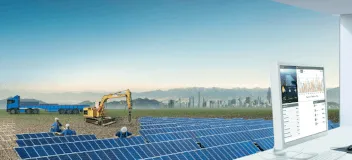
Solar Resource Compass
Solar Resource Compass is an online tool providing solar irradiance data, soiling loss estimates and ground albedo data for solar projects in North America
Sourcing site-specific solar data for your solar projects is challenging - there are many sources for solar irradiance data, but only a few exist for soiling loss estimates, snow loss estimates and ground albedo. For each of these, developers and investors have had to source this data on their own and figure out how to compare the multiple sources for each.
Today, that problem is solved with Solar Resource Compass. DNV's online solar data service serves as an aggregator and calculation engine to provide users with an easy-to-use, on-demand solar data service.
If you're building tools to automate your processes, Solar Resource Compass is also available via API.
 Solar Resource Compass is powered by the same analysis engine used by DNV's energy analysts - providing confidence that your results will match those provided by DNV during financing.
Solar Resource Compass saves you time, but more importantly ensures that you’re not leaving money on the table, or overpaying for an asset.
To try it out immediately, visit src.dnv.com and enter an address - it's that easy.
How can I use it?
Solar Resource Compass is most commonly used to assist developers in determining the solar potential of a project site by helping to identify the right site solar irradiance and ground albedo data to model in their projects, during the feasibility phase, or prior to financing. Whether you need data for a single project or want to compare 100 sites using a python script, Solar Resource Compass will make sure you're making pragmatic decisions about your projects.
The service can also be used when evaluating projects during financing or acquisition to evaluate whether the estimated solar irradiance may be too optimistic, or snow loss estimates are too low. This can improve the site selection process and reduce the likelihood of misalignment between development phase assumptions and financing/re-financing assumptions. Whether you prefer to use the web-based interface or the API, you can be confident that the projects you're investing in haven't made egregious assumptions leading to over-estimated energy estimates.
Solar Resource Compass is part of DNV's commitment to bring transparency and scale to the solar energy modeling process.
How does it work?
Solar irradiance data (also referred to as solar insolation, or sun hours) is available from many sources, but there is considerable variation in the estimates available from both free and paid irradiance data providers as well as data available in common solar maps. At many project locations, the spread between the highest and lowest estimates can exceed 10%. This misalignment between data sources creates uncertainty in the solar energy modeling process. Users who rely on a single source for irradiance data may estimate high at some locations and estimate low at other locations.
To reduce the risk of selecting data that is too optimistic or too pessimistic, Solar Resource Compass allows the user to easily compare solar irradiance data for each site address or project location.

Solar Resource Compass accesses and compares solar irradiance data (for example, GHI, DHI) from multiple data providers and allows you to see how they compare for your project location. By default, Solar Resource Compass will access data from NREL (NSRDB satellite and MTS datasets), Solargis, Meteonorm and DNV’s SunSpot irradiance model. The results of the analysis include a statistical comparison of the available sources presented in a convenient table, chart and map.
Soiling and snow loss estimates are often underestimated due to lack of data. Snow can cause significant losses for PV modules during winter periods. Similarly, dust accumulation between period of rainfall can cause considerable dust losses during dry period. Solar Resource Compass solves this problem by automatically accessing rainfall and snowfall data from NOAA and using that data to estimate the monthly soiling loss for any projects in North America, using the common Kimber soiling loss and Townsend snow loss models. Solar Resource Compass also estimates the benefits of PV module cleaning to allow you evaluate the benefits of several module washing strategies.
With the proliferation of bifacial modules, developers and investors also need guidance on ground albedo. Albedo is defined as the light reflected off the ground and on to the back surface of solar modules. Some surface types, such as snow, have a high albedo, where other surface types, such as wet clay, have a low albedo. It is critical to know whether the ground type and snow cover will create a high albedo for your projects. Solar Resource Compass addresses this need through the use of a proprietary model that estimates the albedo and provides a monthly summary that can be used in any commercial energy modeling software, such as SolarFarmer, PVsyst, and Helioscope.
What is included?
Access to Solar Resource Compass is available as a subscription, allowing you to choose an access level that is appropriate for your volume of projects.
- Irradiance selection analysis - comparison of monthly and annual irradiance data for at least 5 nearby NREL stations, plus NREL’s PSM satellite model, Solargis, Meteonorm and DNV’s SunSpot irradiance data
- Monthly snow loss and dust soiling loss estimates, using data from NOAA and proven industry models
- Monthly ground albedo estimates
- Energy simulation engine for indicative energy estimates [API only]
- The ability to upload your own irradiance data
- Automatic quality checks of each irradiance dataset and flagging of outliers
- Information about each source including distance from site, grid size (for satellite data) and elevation
- Map-based view allowing you to evaluate where stations are location relative to your project location
- Monthly summary table reporting GHI, DHI, temperature and wind speed
- Irradiance charts to evaluate monthly/seasonal consistency
- All data is compatible with common industry energy modeling software such as SolarFarmer, PVsyst and Helioscope.
Access now for a free trial and schedule a demo with us to learn more about the tool.