Remote seabed mapping: A step change in how we document the ocean

As offshore industries expand into more sensitive environments, the way we document and understand the seabed is under increasing scrutiny.
Traditionally, visual seabed surveys have relied on offshore vessel mobilization which increases cost, emissions, and operational exposure. But a new model is emerging: one where high-quality environmental data can be captured and analysed remotely.
A recent pilot at Haltenbanken, Norway, offers a clear signal of this shift.
From offshore campaigns to remote operations
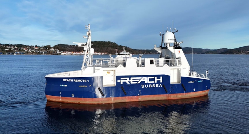
In collaboration with Equinor and Reach Remote, DNV completed its first remote visual seabed mapping survey using an unmanned surface vessel (USV). The objective remained unchanged: document sediment composition and identify species and habitats of environmental concern, including cold-water corals.
What changed was how the work was delivered.
Instead of deploying full offshore crews, the USV with its ROV acted as a remote observation platform, streaming high-quality seabed imagery to onshore experts. Environmental specialists conducted interpretation and analysis in near real time without the need for continuous offshore presence.
This marks a fundamental shift: From offshore-intensive surveys to digitally enabled, remote workflows.
Maintaining trust in a new operating model
For remote methods to scale, one question is critical: can they deliver the same level of confidence?
In this pilot, maintaining regulatory relevance was a key priority. Data quality, traceability, and scientific integrity were preserved through close collaboration between technology providers and environmental experts. The results were delivered in line with regulatory expectations, including reporting to the Norwegian Environmental Agency.
This highlights an important point: Innovation in data collection must be matched by continuity in assurance.
Why this matters for the industry
Remote seabed mapping is not just a technical upgrade – it reflects a broader transition in offshore operations.
Three implications stand out:
- Reduced offshore exposure and costs: Fewer personnel offshore improves safety, reduces costs, and simplifies logistics.
- Lower environmental footprint: Less vessel time translates to reduced emissions.
- Scalable monitoring: Remote solutions open the door to more frequent and flexible environmental surveys.
For operators working in sensitive areas, this combination is increasingly important.
A complementary, not replacement, approach
While remote technologies show clear potential, they are not a one-size-fits-all solution. The experience from Haltenbanken suggests that USV-based mapping can complement – and in some cases replace – traditional methods, depending on site conditions and survey objectives.
The path forward is likely hybrid: combining proven methodologies with new digital capabilities.
Looking ahead
As offshore activities continue to evolve, the demand for efficient, low-impact, and high-confidence environmental monitoring will continue to grow.
Remote seabed mapping illustrates how this balance can be achieved – reducing offshore risks and lower environmental footprint while maintaining the level of insight and assurance required by regulators and society.
For DNV, the Haltenbanken project underlines a long-term commitment to integrating scientific expertise with emerging technologies – supporting customers in navigating evolving environmental requirements and enabling more informed decision-making in a changing ocean environment.
10/21/2026 9:59:00 AM