Remote seabed mapping reduces offshore exposure while maintaining environmental assurance

DNV and Equinor demonstrate how remote seabed mapping using USV technology at Haltenbanken can reduce offshore exposure while maintaining environmental credibility.
Rethinking environmental surveys in sensitive offshore areas
In environmentally sensitive offshore areas such as Haltenbanken, Norway, documenting seabed habitats is essential for responsible development and regulatory compliance. The presence of vulnerable ecosystems, including cold-water corals, requires high-quality environmental data – traditionally obtained through offshore survey campaigns.
For Equinor, this created a need to explore alternative approaches that could reduce offshore exposure while maintaining the robustness and credibility of environmental documentation.
Combining environmental expertise with unmanned systems
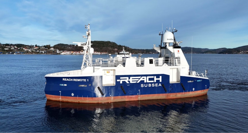
Equinor, Reach Remote and DNV piloted together a new approach to seabed mapping using an unmanned surface vessel (USV). The project combined more than 30 years of environmental assessment experience with emerging remote technologies.
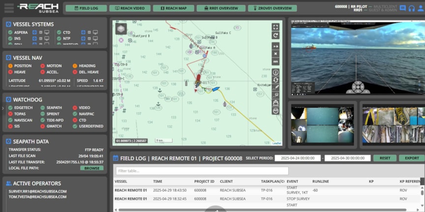
The USV enabled high-resolution visual mapping of sediment composition and identification of red-listed and OSPAR-listed species and habitats of environmental concern (SHEC). DNV’s specialists carried out interpretation and analysis remotely, supported by live data streams and near real-time monitoring.
Working in collaboration with Reach Remote, the team ensured that all data collection, interpretation, and reporting met regulatory requirements, with results delivered to the Norwegian Environment Agency.
Unlocking safer and more efficient environmental surveys
The pilot demonstrated that remote seabed mapping can:
- Reduce offshore personnel exposure and associated risk.
- Maintain high data quality and regulatory confidence.
- Enable more flexible and efficient survey operations.
- Support lower environmental footprint compared to conventional offshore campaigns.
Embedding digital approaches in environmental assurance
As offshore operations continue to evolve, remote and digital solutions are becoming key enablers of safer and more sustainable practices.
The Haltenbanken pilot demonstrates how unmanned technologies can be integrated into established environmental frameworks without compromising scientific integrity or regulatory acceptance. The experience gained will support further development of remote seabed mapping as a complement to traditional survey methods.


